Sharpe Field Library Drone School
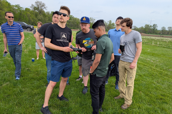


Last week, students from the Department of Geography participated in a hands-on drone photogrammetry demonstration run by Adam Tjoelker through the Sharpe Field Library (SFL). The demo took place at the Turfgrass Facility at Waterman Farms on West Campus and was attended by students who have been participating in the inaugural SFL Drone School cohort over the past academic year.
During the event, students observed the Harris Aerial drone in action, showcasing its high-precision mapping capabilities. They participated in laying ground control points and using (RTK) GPS for accurate positioning. Following the flight, they learned to process imagery using PixElement photogrammetry software, provided in partnership with the Columbus-based company. The session demonstrated how drone imagery can be used to produce 3D models and orthophotos. Students and faculty interested in further training can complete the SFL Drone School Interest Form.