More than just a computer science degree, this major helps you communicate complex data and narratives in visual formats that help your audience see the world more clearly and accurately.
Student Profiles


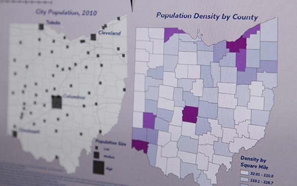
Geographic Information Systems (GIS) allow us to make informed decisions based on geographic data. People intuitively understand maps. Trends and patterns become apparent when viewed on a map. Maps are necessary for solving spatial problems. GIS refers to systems that help us create and understand maps and the data underlying those maps.
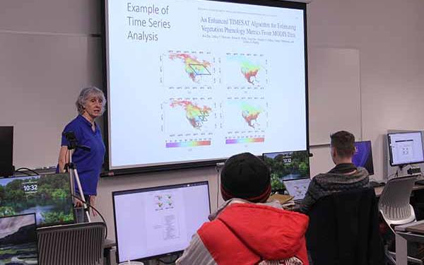
Ohio State University is designated as a Center for Academic Excellence in Geospatial Sciences by the National Geospatial-Intelligence Agency and is among the nation's premier institutions in the development of geospatial technologies. By majoring in GIS, you will learn the tools, methods, and software necessary for managing and analyzing geographic information. You'll develop technical skills through coursework in surveying and measurements, technical mathematics, statistics, remote sensing, and graphics.
If you are a current Ohio State student considering changing to the GIS major, there are no required prerequisites or a required application to declare a major in GIS. However, we strongly recommend that students be in good academic standing and have successfully completed Math 1151 when declaring this major.
Below is a list of some of the issues and topics you'll study:
Issue Analysis
- Air pollution
- Poverty or unemployment
- Planning
Statistical Analysis
- Disease rates
- Elections
- Hazard incidents
Mapping Patterns
- Population change
- Migration
- Development
- Ocean currents
Location Optimization
- Facilities selection
- Mass transit routes
As a GIS student, you are pursuing an education that integrates data analytics, data visualization, and design skills.
According to the U.S. Bureau of Labor Statistics, median pay for data scientists is $103,500 per year and is the third fastest growing job sector for 2022-2032 (at 35%). Cartographers and photogrammetrists earn $72,000 per year with a growth rate of 5%, which is faster than average across fields).
Possible career opportunities include:
- Geospatial Analyst or Consultant
- GIS Software Developer
- Market Researcher or Analyst
- Location/Site Selection Expert
- Business Analyst
- Mapping Technician
- Cartographer for Federal Agencies (USGS, NGA, USFS, etc.)
- Local Government GIS Analyst
Bureau of Labor Statistics, U.S. Department of Labor, Occupational Outlook Handbook, Cartographers and Photogrammetrists,
at https://www.bls.gov/ooh/architecture-and-engineering/cartographers-and-photogrammetrists.htm
Bureau of Labor Statistics, U.S. Department of Labor, Occupational Outlook Handbook, Data Scientists,
at https://www.bls.gov/ooh/math/data-scientists.htm
Curriculum for Geographic Information Science (BS)
If you are a student considering the Geographic Information Science degree, the downloadable file below will provide further information on the courses required.
Advising Sheet
Major curriculum information for students enrolling at OSU and declaring a GIS major during Spring 2024 or beyond, use this document.
General Education Requirements
Every student at Ohio State completes courses in General Education (GE). Although these GE courses are meant to provide a broad baseline of learning, often the courses supplement the student’s major or program. The requirements vary depending on whether you are pursuing a Bachelor of Arts degree, a Bachelor of Science degree. If you are not sure which curriculum you are following, ask your advisor. The College of Arts and Sciences has all the information you need to keep track of your General Education requirements.
GIS Minor
Curriculum for Geographic Information Science (BS)
If you are a student enrolled in the department between Autumn of 2022 and Autumn of 2023, please use the following advising sheet:
Advising Sheet
General Education Requirements
Every student at Ohio State completes courses in General Education (GE). Although these GE courses are meant to provide a broad baseline of learning, often the courses supplement the student’s major or program. The requirements vary depending on whether you are pursuing a Bachelor of Arts degree, a Bachelor of Science degree. If you are not sure which curriculum you are following, ask your advisor. The College of Arts and Sciences has all the information you need to keep track of your General Education requirements.
Curriculum for Geographic Information Science (BS)
If you are a student enrolled in the department during Summer of 2022 and before, please use the following advising sheet:
Advising Sheet
General Education Requirements
Every student at Ohio State completes courses in General Education (GE). Although these GE courses are meant to provide a broad baseline of learning, often the courses supplement the student’s major or program. The requirements vary depending on whether you are pursuing a Bachelor of Arts degree, a Bachelor of Science degree. If you are not sure which curriculum you are following, ask your advisor. The College of Arts and Sciences has all the information you need to keep track of your General Education requirements.